Current Projects
Wind Forecast Improvement Project (WFIP-3)
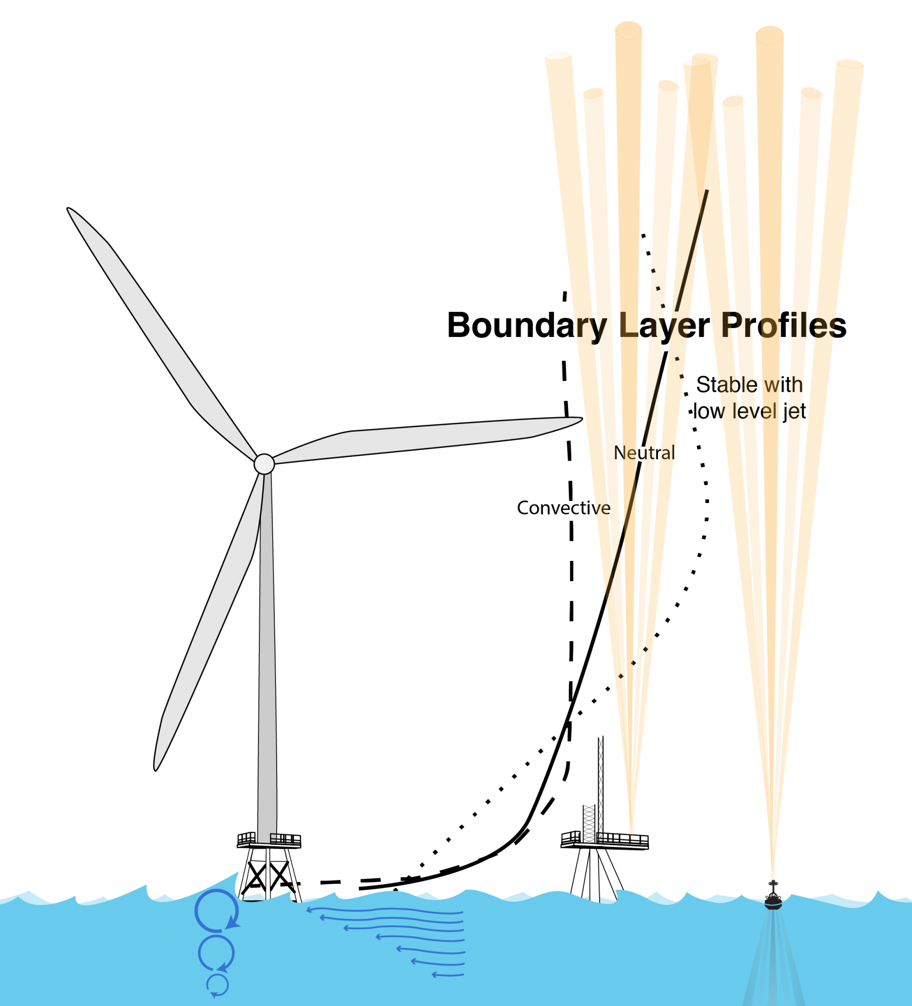
The 3rd Wind Forecast Improvement Project (WFIP3), sponsored by the U.S. Department of Energy, seeks to improve our understanding of the physics of the atmosphere and ocean that dictate the structure and variability of the wind resource within the Marine Atmospheric Boundary Layer (MABL).
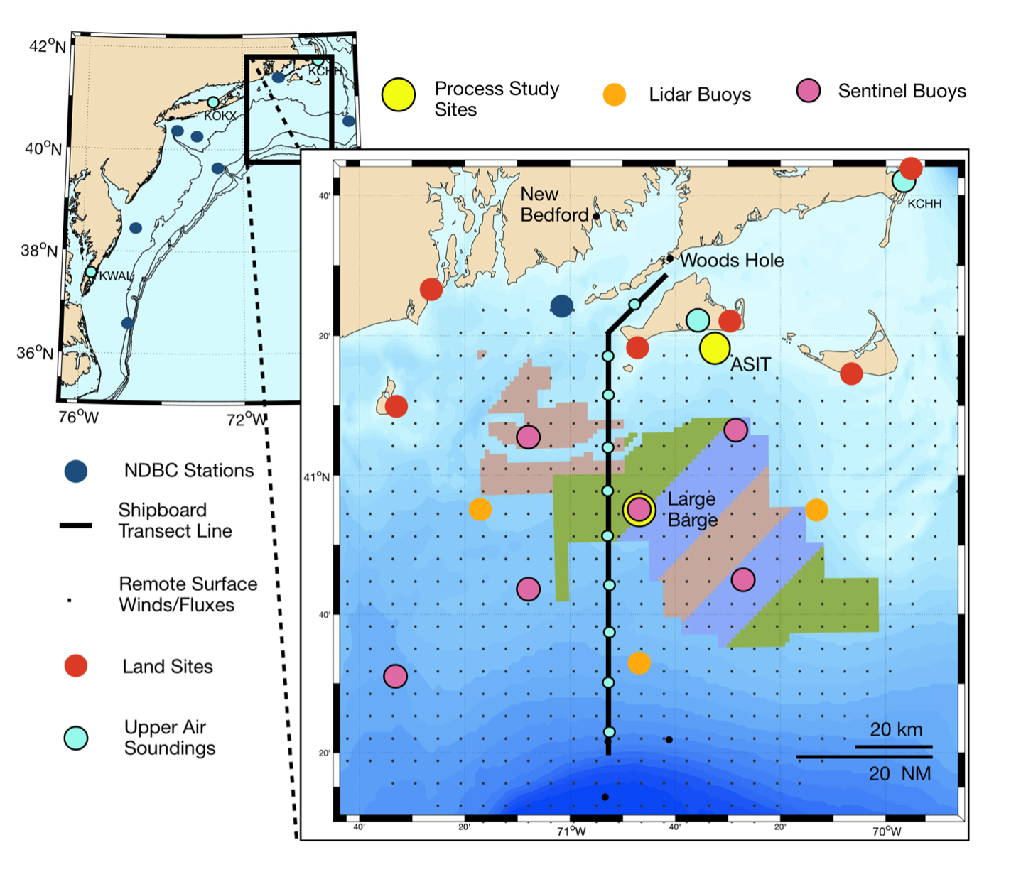
This 5-year effort, started in the fall of 2021 will carry out a multi-seasonal offshore field measurement campaign in 2024-2025, linked to intensive numerical modeling development and validation efforts, that will:
- Improve the physical understanding of mesoscale meteorological and oceanographic processes that directly affect wind resource characterization in the U.S. East Coast offshore environment.
- Deploy and operate a 3-D multiscale sensor array to characterize vertical and horizontal structure of the marine boundary layer to provide the observations necessary to improve our understanding of these processes, improve and assess numerical weather forecasting models.
- Incorporate and validate the new understanding into foundational numerical weather forecasting models and other physics-based atmospheric and oceanographic models to improve wind energy forecasts.
This work will be carried out by a collaborative team of research institutions, led by the Woods Hole Oceanographic Institution (WHOI), working with the national labs of the Department of Energy (DOE) and the National Oceanic and Atmospheric Administration (NOAA). The project team receives input from a User Advisory Board composed of a broad coalition of industry partners and ocean stakeholders.
Metocean Monitoring Campaign for Offshore Wind Energy
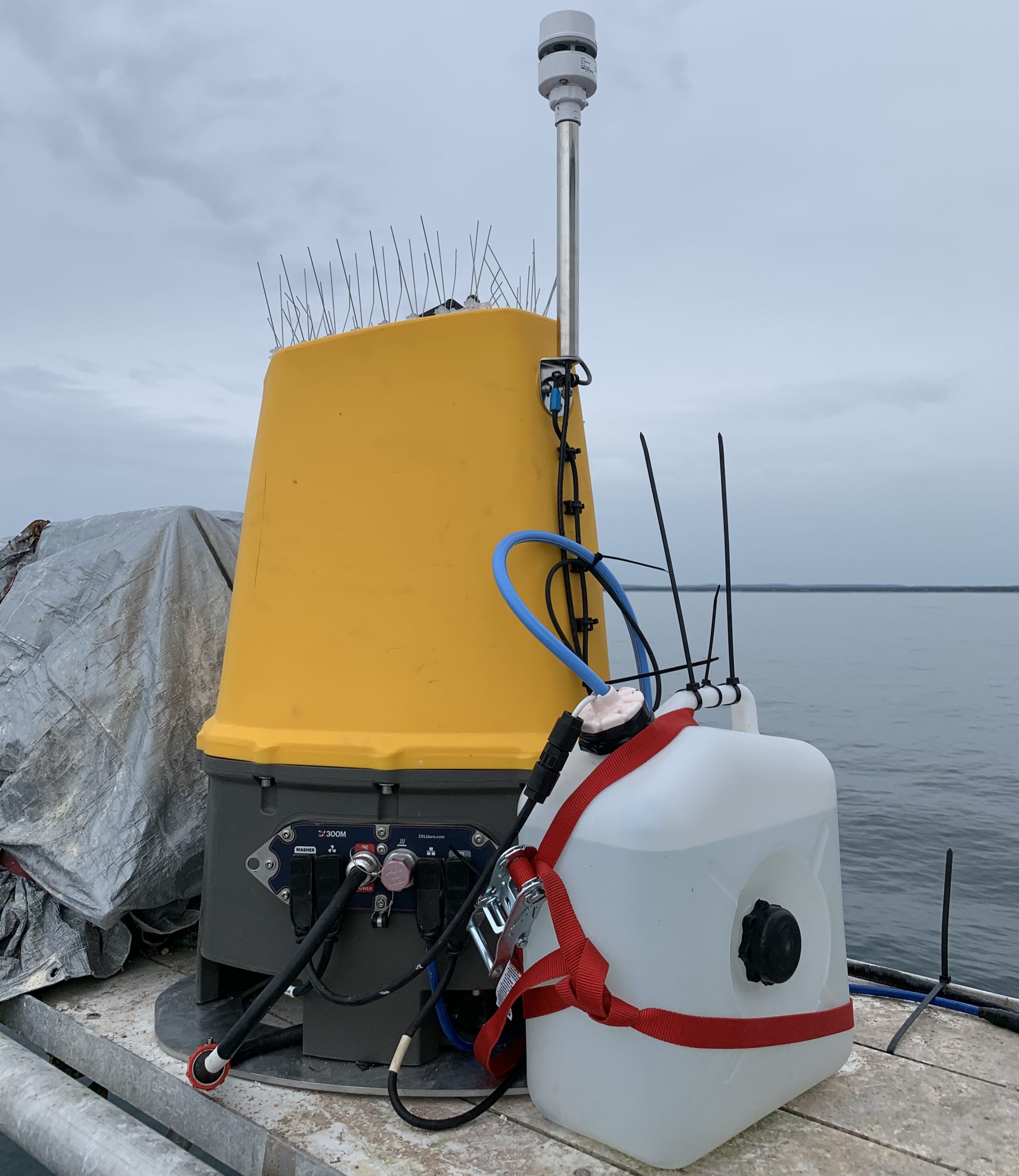
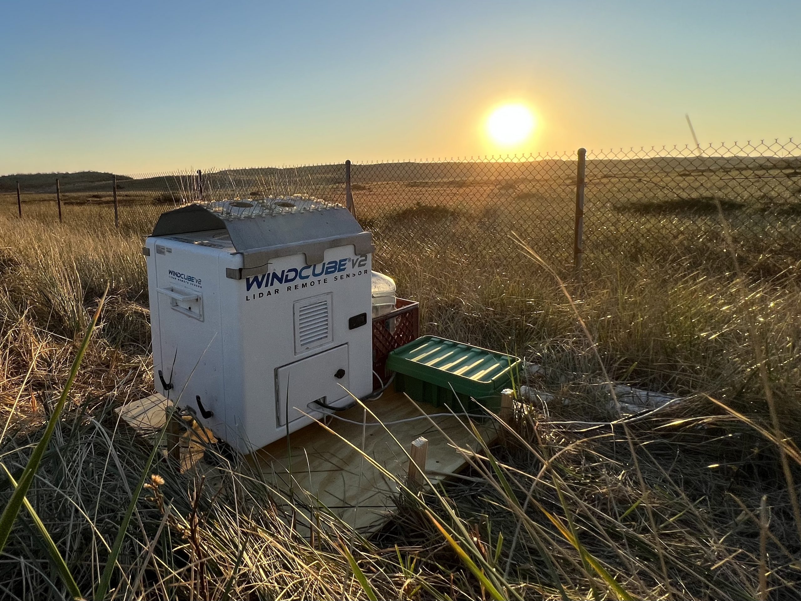
Since 2016, WHOI has carried out a long-term metocean monitoring campaign at the ASIT. The project was initially supported by the Massachusetts Clean Energy Center and maintains a Zephir 300M vertically profiling lidar system at the tower as well as two standard cup anemometers and one wind vane at the top of the tower structure. A Windcube V2.0 was maintained on the ASIT from 2016-2021, and after a period of validation with the Zephir lidar was relocated to The Nantucket Test Site (NTS) in November 2021. AWS-Truepower-UL has provided third-party validation of all metocean installed sensors. Data from the system have been used by developers in resource assessments and power purchase agreement bids as well as by researchers (e.g. Bodini et al. 2019). The Windcube lidar was removed from the tower for servicing and re-validation in 2019, before being reinstalled October 2019. Recently, this observational effort has begun supporting the U.S.-based lidar-buoy validation efforts with the two DOE-owned buoys being successfully validated at the ASIT during the first few months of 2020.
See current vertical wind profile data here, and please contact MVCO for more information about the program, data access, or use of the facility as a validation location.
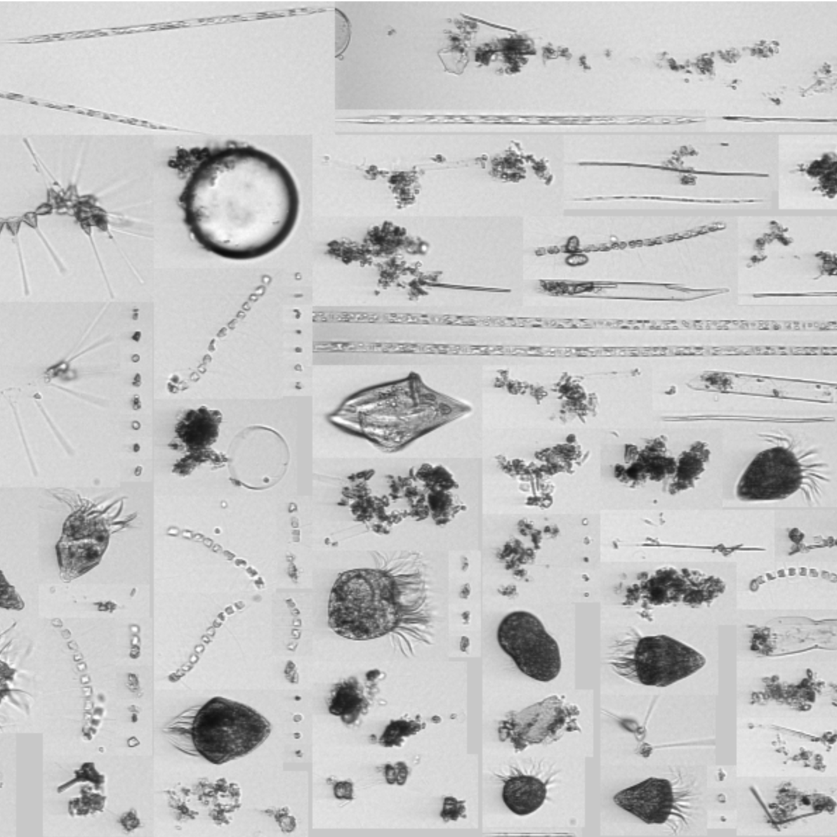
Northeast U.S. Shelf Long-Term Ecological Research (NES-LTER)
The NES-LTER project integrates observations, experiments, and models to understand and predict how planktonic food webs are changing, and how those changes may impact the productivity of higher trophic levels. NES-LTER project lead, Heidi Sosik, and collaborators conduct biological observations at the MVCO offshore tower including an underwater microscope, the Imaging FlowCytobot. The NES-LTER project is funded by the National Science Foundation.
See phytoplankton in near-real-time at the IFCB Dashboard here: https://ifcb-data.whoi.edu/timeline?dataset=mvco