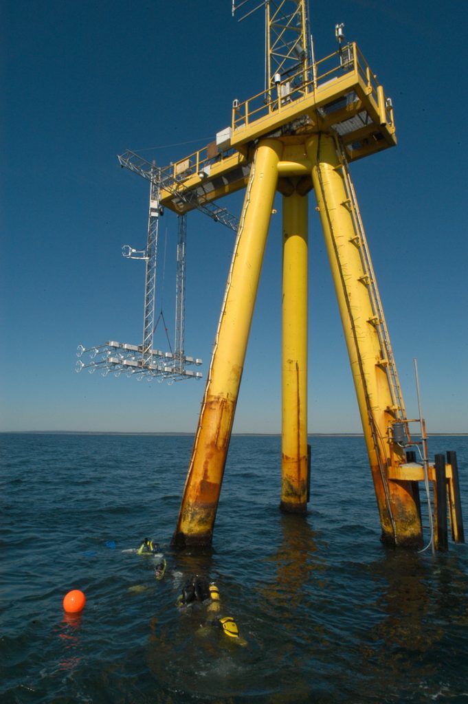
Infrastructure
MVCO is a network of instrument-hosting nodes located on and near South Beach on Martha's Vinyard.
Met Tower
41° 20.996' N, 70° 31.60' W
(41.3499, -70.5267)
1: met tower details
2: met tower construction history

ASIT
41°20.1950'N, 70°33.3865'W
(41.3366, -70.5564)
1: ASIT tower details
2: ASIT tower construction history
12m Node
41°19.500'N, 70°34.0'W
(41.325, -70.5667)
1: 12m Node details
2: 12m Node construction history
Cabling and Connectivity
1: Description of the Network
2: description of history and construction of shorelab and cabling
The 2019 Overhaul
In 2018 the observatory suffered a severe power-cable failure. MVCO took the opportunity to lay new cabling and make improvements touching much of the infrastructure.
STUFF FROM OLD WEBSITE - unfinished transfer
How was it built?
The shore laboratory located at Katama Air Park is the termination point for the fiber-optic power cable. It contains the computer systems and power supplies necessary for controlling the sensors and logging the data locally. A 10-meter mast extending above the laboratory holds sensors to measure solar and infrared radiation, rainfall rate, temperature, humidity, wind speed and direction. The shore laboratory is connected to WHOI via a high-speed wireless radio and a commercial leased-line as back-up. The laboratory includes an automatic backup-power generator to continue operation of the entire system during power outages. All computer and equipment operations will be monitored remotely from WHOI.
Cable Description and Installation
The cable consists of six AWG13 copper power conductors, with high voltage insulation. Ten single-mode optical fibers are contained in a loose-tube assembly at the center of the cable. The core is jacketed with a polyurethane sheath protected by two layers of cross-laid armor wire and a polyethylene outer jacket.
To cross the beach area with the least environmental impact, WHOI utilized directional drilling technology. This technology, originally developed for use in oil fields, is only just coming within economic reach of science. The drilling operation, accomplished in May 2000, provided a steel conduit, 626 meters in length, between the airfield and the seafloor (approximately 300 meters from the beach in about 3 meters water depth). A second conduit (206 meters in length) was drilled to provide a cableway to the meteorological sensor mast located on the beachfront next to Donnelly House.
The cable was then pulled back through each conduit and connected to a junction box on the airfield and then to the lab. The offshore cable was laid on the bottom, then jetted under the sand using an underwater cable jet-plow.
The Sea Node
At the 12-meter isobath, approximately 1.5km south of the Edgartown Great Pond is the instrument "node". The node consists of a 12" diameter steel pedestal jetted into the bottom with a four-foot square instrument frame sitting on top. The node contains all the electronics for connecting the scientific instruments and sending the data back to shore. Divers can mount instruments on or near the node and simply plug into an underwater connector that will provide power and two-way data communications.
The Air-Sea Interaction Tower (ASIT)
The Air-Sea Interaction Tower was completed in the summer of 2002 about three kilometers from shore along the 15-meter isobath. The tower is equipped with a 19-port node providing power and two-way data communication to shore. In July 2003, a beam was installed between two legs to provide a platform at four meters below mean sea level. Users can reach the node top-side by climbing to a platform, which is 12 meters above sea level. A met mast was mounted to provide air-side observations to 10 meters above the service platform or 22 meters above sea level.